Links of Interest
(Click to Open)
LISTEN Now,
On-line to
Classical Music
102.1 FM, KDFC
(click)

CALIFORNIA
SKI REPORT
(click icon)
WEATHER

•Weather Home Page


•LOOMIS, CA
WEATHER HISTORY


Loomis Weather Profile


•CALTRANS
Road Conditions


•Region
SPARE THE AIR
REPORT


COSMOS

•SUMMER/FALL
ASTRONOMY


•Earth and Moon
Viewer
(View the Solar
Day from Space)


•TERRASERVER
Photographic
Imagery
from Space


LOOMIS BASIN

•Town of Loomis


•Loomis Events
Calendar


•Loomis Basin
Historical Society


•Loomis Basin
Chamber of Commerce


•South Placer
Heritage Foundation


•Exploring
Placer County


•SeekOn / Loomis


SERVICES

•PARK PLACE
GARDENS NURSERY


•PRICELINE.COM
Savings on Airline
Tickets, Hotels,
Cars and More!


EDUCATION

•DEL ORO
HIGH SCHOOL


•SIERRA COLLEGE
Community Education


•CALIFORNIA
STATE UNIVERSITY


•U.C. DAVIS
Website


ARTS,
ENTERTAINMENT

•JEFF PARKS, Tenor
Classics to Contemporary
Listen on ReverbNation


•LATEST ARTS
AND ENTERTAINMENT
INFORMATION


•TICKETS.COM
Events, On-line
Purchases


•TICKETMASTER


•CAPITAL
PUBLIC RADIO
KXPR and KXJZ
Classical / Jazz


•News Talk
1 5 3 0
K F B K


•AM 1380 - KTKZ
THE RIGHT CHOICE !


NEWS

•WORLD NET DAILY


•The DRUDGE Report


•CBS 13
Sacramento


•FOX NEWS - US,
World News, Sports,
Entertainment & More!


INVESTMENTS

•NEW YORK STOCK
EXCHANGE


INTERACT

•LOOMIS CHAT
ROOM


•TEEN MANIA
MINISTRIES

The Climate of Loomis


The Loomis Basin
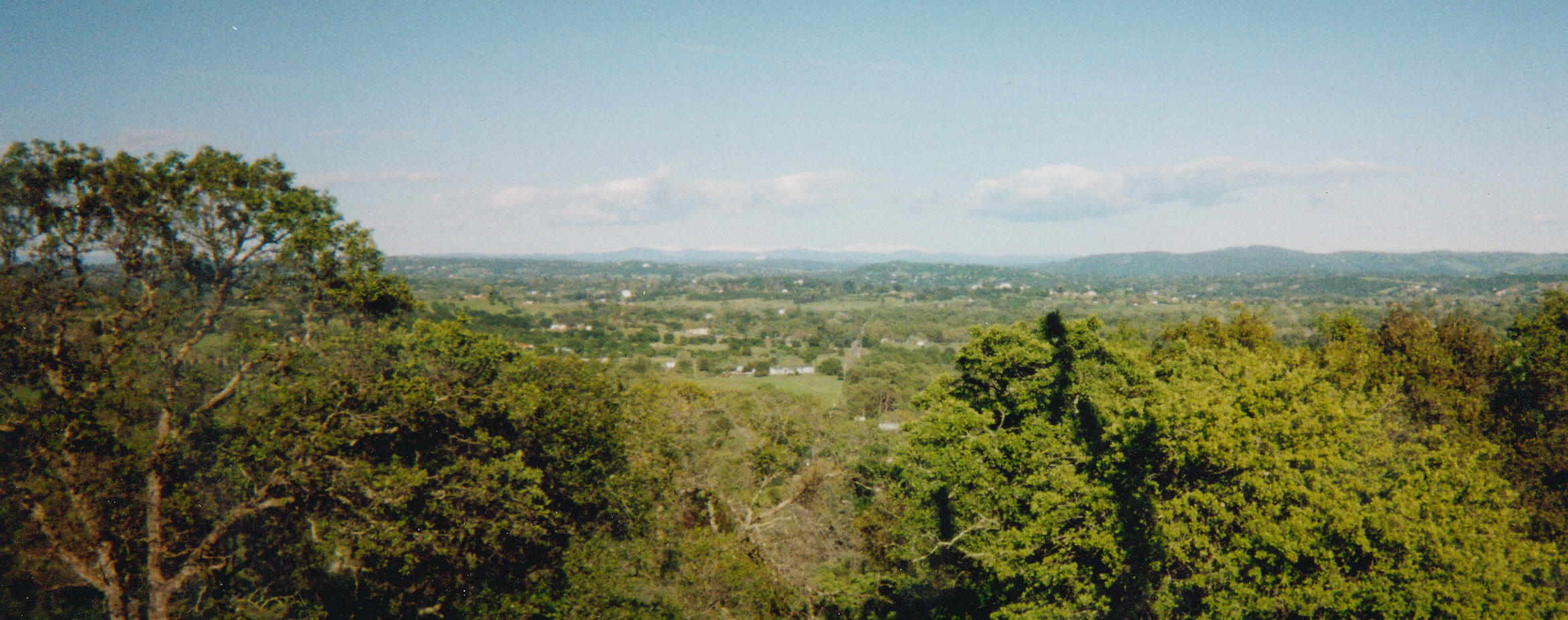
I would classify Loomis as an "Intermediate Mediterranean / Semi-mediterranean" climate. It is Mediterranean in the sense that there is a dry season and a wet season. The dry season usually lasts five months and the wet season lasts seven months. Rainfall during the late spring, summer and fall, dry season, averages 8.71 inches, while the winter and spring, wet season, averages 34.24 inches. The usage of describing the climate as intermediate / semi-mediterranean results from the Loomis Basin being located between two climate zones. Loomis borders the climates of Southern California / Central California and the Northwest (Oregon-Washington). In addition, Loomis has the distinction of a first tier interior climate with overriding marine influences. In other words, it is still situated within the western, moist side of the Sierra-Nevada mountains, but with more interior characteristics. These geographic factors create a more distinct "four season" temperature difference.
As the years of my keeping weather records have passed by and the statistical data has accumulated, it could be argued that the climate of Loomis holds unique micro climate characteristic (Also see Loomis, CA Weather / Climate History). These are differences even unto the climates of Loomis's closest neighbors of Rocklin-Roseville and Auburn, California. Regionally this is not unusual in this part of California due to the topography. Because the Loomis Basin sets at the base of the Sierra-Nevada mountain range, elevations increase rapidly to the east in hundreds of feet per mile. While this change in elevation is more gradual to the west, it is somewhat significant as it relates to climactic differences.
SUMMER IN LOOMIS Summers are much like coastal Southern California, only slightly warmer, when "Delta" maritime breezes are present. The Delta, ocean breezes flow from the southwest to the northeast, traveling up the Sacramento River delta. Because of the river delta and the absence of coastal mountains blocking ocean, maritime breezes, welcome cooling takes place during the normally hot summer months in the Sacramento Valley and Sierra Nevada Foothills. Our area, in interior California, is the only region to have this benefit.
In contrast, when Delta breezes aren't blowing, and the winds come overland from the north, generally hot conditions prevail. Yet, additional evidence of the Loomis microclimate is noticeable, as summer high tempertures usually run 3 to 5 degrees cooler than Sacramento or Roseville, California. This difference can be explained by the fact that Loomis is surrounded by foothills, which block off many of the occasional summer, hot north winds. Additionally, a slightly higher elevation in Loomis, than the valley floor, reduces high temperature readings. The surrounding native forests of Interior Live Oak, Cottonwood, Digger and Ponderosa Pines augment lower summer high temperatures to that of the Sacramento Valley. Trees add additional cooling. It not surprising that the town of Loomis holds trees, not concrete parking lots, in higher esteem than over development. Obviously, the more concrete and fewer trees, the higher summer temperatures will be.
AVERAGE TEMPERATURES:*
MONTH
LOW
HIGH
JAN.
36.33
53.50
FEB.
38.5
58.00
MAR..
39.50
65.17
APR..
42.71
67.86
MAY.
48.29
75.29
JUN..
53.29
83.14
JUL..
56.00
88.86
AUG..
57.00
90.29
SEP..
53.71
85.71
OCT..
46.43
76.29
NOV..
41.71
63.29
DEC..
36.17
55.00

To summarize the conditions of summer, the climate in Loomis is more like interior Southern California, only much cooler, when maritime influences are not present. This is due to a more northerly latitude and westerly longitude. Also, the Pacific Ocean near Loomis is both to the west and south, allowing more cooling ocean humidity into the area. Desert southwest monsoons sometimes, but rarely, effect Loomis in summer. Summer is a good time for most meteorologists to take a vacation in Northern California, unless there's a heat wave. Many are found on golf courses from 5:30 AM till 9:00 PM PDT.
WINTER IN LOOMIS Winters in Loomis are more characteristic of Oregon and Washington, with rain and fog occurring frequently. The difference between Northern California and the Pacific Northwest comes in slightly warmer temperatures, due to a more southerly latitude. Winter storms can come from three different sources. The first and the most common are storms coming from north Pacific. These storms bring rain and fog to the coast, then track right through the Sacramento River Delta and on up into the foothills. Weather radar usually tracks these storms moving right up Interstate 80 (and into Loomis) in a northeast direction. These storms can bring explosive amounts of water as they hit the foothills and mountains of the Sierra Nevada. On occasion, foothill runoff can produce flooding in Sacramento Valley locations. This is particularly the case, when warm, tropical Pacific moisture from the Hawaiian Islands combines with north Pacific storms. These storms are sometimes called "The Pineapple Express."
AVERAGE PRECIPITATION:*
AVE./MO
MONTH
11.23
January
9.87
February
4.31
March
3.30
April
2.60
May
0.67
June
Trace
July
0.08
August
0.43
September
1.63
October
4.38
November
4.45
December

The second type of winter storm comes from the Gulf of Alaska. These are much colder storms than the first type. Snow levels can fall as low as 500 feet elevation. When this happens many foothill, and mountain roads close or have snow-chain tire requirements on vehicles. However, while Loomis's neighbor, Auburn, nine miles to the northeast might have accumulations of snow, Loomis will only see a flake or two. This is due to our having a lower elevation than Auburn.
The third type of winter storm comes from Canada and is rare. These are very cold. When they manage to make it across the barrier, eastern mountains coming from places such as Idaho, Montana and Nevada, snow can fall as low as the Sacramento Valley floor. If these systems bring clear weather, freeze warnings are a sure bet for the long, winter overnight hours.
Of note, and not too well known outside this area, spring can bring small tornadoes to the Valley. This usually occurs in March and April and they are certainly not the size of those in the Midwest, Oklahoma or Texas. Hurricanes never occur, due to cold water temperatures offshore Northern California in the Pacific Ocean.
The annual rainfall in Loomis, at the time this article was written, with at least 10 year plus period of records, was 42.95 inches. However, it should be noted that these years were wetter than previous years, based on regional 100 year records. Additional records should be kept in order to determine more precise averages. It is more likely the actual average is around 37 to 39 inches. As mentioned previously, most of the precipitation in Loomis falls during the months of November, December, January, February and March.
In conclusion, one could say that the climate in Loomis is very pleasant and healthy. This is a climate which is probably one of the best and most desirable in the world.
*(Month to month statistics on Loomis, CA with an annual focus:)
(Written by Jeff Parks)

Other Links: